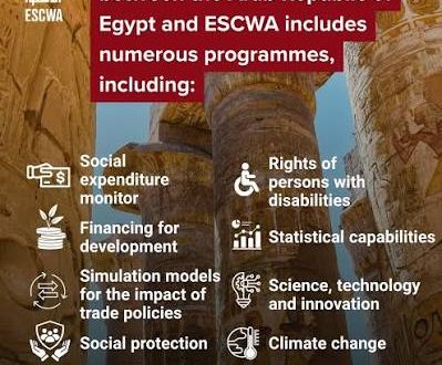
ESCWA backs Egypt’s SDG drive through finance, social protection, climate cooperation
The United Nations Economic and Social Commission for Western Asia (ESCWA) reaffirmed its commitment to ...

The Libyan natural disaster highlighted the need for the international “Early Warnings for All” campaign launched by United Nations Secretary-General António Guterres, especially as the planet warms, more extreme rainfall events and severe flooding is expected.
The World Meteorological Organization (WMO) is partnering with the UN Office for Disaster Risk Reduction, the International Telecommunications Union, the IFRC and a range of other partners to ensure that early warnings reach everyone and lead to early action.
“A warmer atmosphere can hold more moisture. Therefore, precipitation events – with rain, snow or hail – in a warmer climate are more intense and can lead to more flooding,” says Stefan Uhlenbrook, Director of Hydrology and Cryosphere at WMO. “More than 80% of the moisture in clouds originates from the oceans, even more in tropical cyclones. This means that increasingly warmer oceans will fuel storms further,” he says.
Sea surface temperatures above 26 °C can enhance and fuel such storms after they develop. Near the coast of Libya, sea surface temperatures were above 27.5 °C, thus increasing the energy available for the convection and moisture.
Libya’s National Meteorological Center did indeed issue early warnings for this extreme weather event, which saw unprecedented rainfall levels (414.1 mm in 24 hours in one station) which caused the flash floods and the collapse of the dams. The warnings were issued for heavy precipitation and floods, but didn’t address the risk posed by the ageing dams.
The fragmentation of the country’s disaster management and disaster response mechanisms, as well as deteriorating infrastructure, exacerbated the enormity of the challenges. The political situation is a driver of risk, as we are seeing in many countries currently.
The National Meteorological Center faces major gaps in its observing systems. Its IT systems are not functioning well and there are chronic staff shortages. The National Meteorological Center is trying to function, but its ability to do so is limited. The entire chain of disaster management and governance is disrupted.
Storm Daniel developed in Greece and was named by the Hellenic National Meteorological Service. As it moved towards Libya, Storm Daniel developed the characteristics of a Medicane – MEDIterranean hurriCANE. This hybrid phenomenon shows some characteristics of a tropical cyclone and others of a mid-latitude storm. Activity historically peaks between September and January.
Storm Daniel caused record-breaking rainfall in Greece on 5-6 September, with a reported 750 mm falling in 24 hours at a station in the village of Zagora. This is the equivalent of about 18 months of rainfall. In Thessaly, central Greece, many stations received 400 to 600 mm of rainfall in 24 hours. Thessaly is Greece’s agricultural heartland, and so the economic impacts are expected to be serious.
There were a number of fatalities. Many people sought refuge on rooftops.
Concurrently, Greece was battling Europe’s biggest ever wildfire, which caused massive destruction in the northeast of the country.
The disasters continue the series of extreme events which have caused loss of livelihoods and lives in many countries around the world in recent months.
The United Nations Economic and Social Commission for Western Asia (ESCWA) reaffirmed its commitment to ...
The African Development Bank (AfDB) is backing Morocco’s clean energy ambitions with a €100 million ...
Egypt is advancing one of the Middle East’s largest waste treatment projects with the integrated ...
Leave a comment